The Shira Route Of Mount Kilimanjaro | 2nd Shortest Ascent Route
Shira Climbing route of Kilimanjaro With a total length of about 56 km (35 miles), is the second-shortest route of the seven Kilimanjaro climbing route after Umbwe route. The shira route of climbing Mount Kilimanjaro, can be accomplished in 6 days or 7 days, with the longest Mount Kilimanjaro climbing itinerary adding an extra day for acclimatization.
Overview of the Shira Route
The Shira Route begins on the western side of Mount Kilimanjaro, initially following the path of the Lemosho Route. It starts at the Shira Ridge, offering trekkers a high-altitude beginning and magnificent views from the onset. The route traverses the Shira Plateau before merging with the Machame Route, continuing towards the summit.
Key Features:
- Route Length: Approximately 56 kilometers (35 miles)
- Duration: Typically 7 to 8 days
- Difficulty: Moderate to high
- Success Rate: Around 85% for 8-day treks
7 Days Kilimanjaro Climbing Shira Route
Day 1: Londorossi Gate to Shira 1 Camp
- Elevation: 2,360 meters (7,742 feet) to 3,610 meters (11,843 feet)
- Distance: 5 km (3.1 miles)
- Duration: 3-4 hours
The trek begins with a drive from Londorossi Gate to the Shira Ridge. Trekkers start their journey at a high altitude, walking across the Shira Plateau to Shira 1 Camp, enjoying spectacular views and a relatively gentle hike.
Day 2: Shira 1 Camp to Shira 2 Camp
- Elevation: 3,610 meters (11,843 feet) to 3,850 meters (12,631 feet)
- Distance: 7 km (4.3 miles)
- Duration: 3-4 hours
Day two involves a gradual ascent across the Shira Plateau, a unique high-altitude desert. Trekkers will witness stunning vistas of the surrounding peaks and the expansive plateau before reaching Shira 2 Camp.
Day 3: Shira 2 Camp to Barranco Camp via Lava Tower
- Elevation: 3,850 meters (12,631 feet) to 3,900 meters (12,795 feet)
- Distance: 10 km (6.2 miles)
- Duration: 6-8 hours
This challenging day includes a climb to Lava Tower at 4,640 meters (15,223 feet) for acclimatization, followed by a descent to Barranco Camp. The route offers diverse scenery and a crucial opportunity for altitude adaptation.
Day 4: Barranco Camp to Karanga Camp
- Elevation: 3,900 meters (12,795 feet) to 3,995 meters (13,106 feet)
- Distance: 5 km (3.1 miles)
- Duration: 4-5 hours
The trek begins with the Barranco Wall, a steep but non-technical climb. The path then descends into the Karanga Valley before ascending again to Karanga Camp, providing spectacular views and essential acclimatization.
Day 5: Karanga Camp to Barafu Camp
- Elevation: 3,995 meters (13,106 feet) to 4,673 meters (15,331 feet)
- Distance: 4 km (2.5 miles)
- Duration: 3-4 hours
A short but steep trek leads to Barafu Camp, the base camp for the summit attempt. Trekkers rest and prepare for the final ascent, which begins around midnight.
Day 6: Barafu Camp to Uhuru Peak, then descent to Mweka Camp
- Elevation (Ascent): 4,673 meters (15,331 feet) to 5,895 meters (19,341 feet)
- Elevation (Descent): 5,895 meters (19,341 feet) to 3,068 meters (10,065 feet)
- Distance (Total): 17 km (10.6 miles)
- Duration: 12-15 hours
The summit push begins early, aiming to reach Uhuru Peak at sunrise. After celebrating at the summit, trekkers descend to Barafu Camp for a short rest, then continue down to Mweka Camp.
Day 7: Mweka Camp to Mweka Gate
- Elevation: 3,068 meters (10,065 feet) to 1,640 meters (5,381 feet)
- Distance: 10 km (6.2 miles)
- Duration: 3-4 hours
The final descent passes through lush rainforest to Mweka Gate, where successful trekkers receive their certificates.
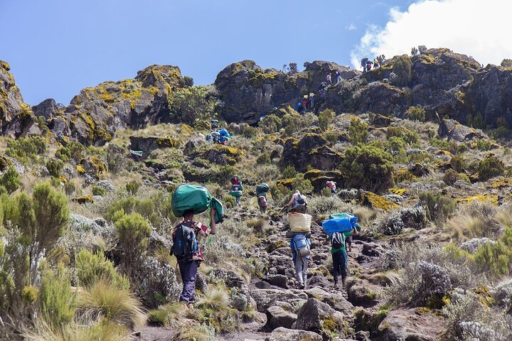
Benefits of the Shira Route
- Scenic Diversity: The Shira Route offers stunning vistas from the Shira Plateau, traversing varied landscapes including high-altitude deserts and lush rainforests.
- High Starting Point: The initial high elevation at Shira Ridge aids in early acclimatization, potentially reducing the risk of altitude sickness.
- Less Crowded: Compared to popular routes like Machame and Marangu, the Shira Route sees fewer trekkers, offering a more tranquil experience.
- Acclimatization Opportunities: The itinerary includes several days with significant elevation changes, promoting better acclimatization.
Challenges and Considerations
- Physical Demands: Despite its acclimatization advantages, the Shira Route is physically demanding and requires good fitness levels.
- Cold Weather: High altitudes and nighttime summit attempts mean extremely cold conditions. Proper gear is essential.
- Altitude Sickness: While the route helps with acclimatization, altitude sickness remains a risk. Trekkers should monitor symptoms and be prepared to descend if necessary.