The Rongai Trail Route Of Climbing Mount Kilimanjaro
Rongai Climbing Route Of Kilimanjaro stands out for its unique approach from the north, less crowded paths, and diverse landscapes. This comprehensive guide delves into the specifics of the Rongai Route, covering its highlights, challenges, and what climbers can expect on this memorable journey.
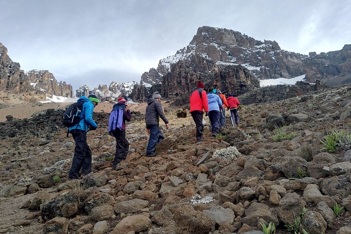
The Rongai Route is the only trail that starts from the northern side of Kilimanjaro, near the Kenyan border. Known for its remote and unspoiled terrain, this route provides a different perspective on the mountain compared to the more popular southern and western approaches. The Rongai Route is often chosen by those seeking a quieter climb and a gradual ascent profile, making it suitable for trekkers with varied experience levels.
Key Features Of The Rongai Route Of Mount Kilimanjaro
- Route Length: Approximately 72 kilometers (44.7 miles)
- Duration: Typically 6 to 7 days
- Difficulty: Moderate
- Success Rate: Around 85% for 7-day treks
7 Days Rongai Route Mount Kilimanjaro Trek
Day 1: Nalemoru Gate to Simba Camp
- Elevation: 1,950 meters (6,398 feet) to 2,671 meters (8,764 feet)
- Distance: 8 km (5 miles)
- Duration: 3-4 hours
The trek begins at Nalemoru Gate after a drive through rural villages and farmland. The path ascends gently through cultivated fields and pine forests to Simba Camp, where trekkers spend their first night.
Day 2: Simba Camp to Second Cave Camp
- Elevation: 2,671 meters (8,764 feet) to 3,450 meters (11,319 feet)
- Distance: 6 km (3.7 miles)
- Duration: 3-4 hours
Day two involves a steady climb with increasing views of the Kenyan plains and Kibo Peak. The path winds through heather and moorland, leading to Second Cave Camp.
Day 3: Second Cave Camp to Kikelewa Camp
- Elevation: 3,450 meters (11,319 feet) to 3,600 meters (11,811 feet)
- Distance: 9 km (5.6 miles)
- Duration: 5-6 hours
The trek to Kikelewa Camp includes more dramatic changes in landscape, with the moorland giving way to the alpine desert. This day is crucial for acclimatization as the route gradually ascends.
Day 4: Kikelewa Camp to Mawenzi Tarn Camp
- Elevation: 3,600 meters (11,811 feet) to 4,330 meters (14,206 feet)
- Distance: 6 km (3.7 miles)
- Duration: 3-4 hours
The trek to Mawenzi Tarn Camp is relatively short but steep, with trekkers navigating rocky terrain. The camp is set in a picturesque location beneath the jagged peaks of Mawenzi, offering stunning views.
Day 5: Mawenzi Tarn Camp to Kibo Hut
- Elevation: 4,330 meters (14,206 feet) to 4,695 meters (15,404 feet)
- Distance: 8 km (5 miles)
- Duration: 5-6 hours
This day involves a long trek across the desolate saddle connecting Mawenzi and Kibo. The barren landscape can be challenging, but it provides an unforgettable sense of remoteness. Trekkers reach Kibo Hut in the afternoon, resting before the summit attempt.
Day 6: Kibo Hut to Uhuru Peak, then descent to Horombo Hut
- Elevation (Ascent): 4,695 meters (15,404 feet) to 5,895 meters (19,341 feet)
- Elevation (Descent): 5,895 meters (19,341 feet) to 3,720 meters (12,205 feet)
- Distance (Total): 22 km (13.7 miles)
- Duration: 12-15 hours
The summit push begins around midnight, with trekkers aiming to reach Uhuru Peak at sunrise. The climb involves a strenuous ascent to Gilman’s Point before traversing the crater rim to Uhuru Peak. After celebrating the summit, trekkers descend to Kibo Hut for a brief rest and then continue down to Horombo Hut.
Day 7: Horombo Hut to Marangu Gate
- Elevation: 3,720 meters (12,205 feet) to 1,860 meters (6,102 feet)
- Distance: 20 km (12.4 miles)
- Duration: 5-7 hours
The final descent takes trekkers through the lush rainforest to Marangu Gate. Here, successful climbers receive their certificates before departing for Moshi.
Benefits of the Rongai Route
- Less Crowded: Compared to the southern routes, Rongai sees fewer trekkers, offering a more solitary and tranquil experience.
- Gradual Ascent: The route’s gentle incline allows for better acclimatization and reduces the risk of altitude sickness.
- Varied Scenery: Starting from the dry northern side, the route provides diverse landscapes, from farmlands and forests to moorlands and alpine desert.
- Wildlife Sightings: The northern forests are home to various wildlife, including elephants and buffaloes, enhancing the trekking experience.
Challenges and Considerations
- Physical Fitness: While the ascent is gradual, the route still demands a good level of fitness and stamina, especially for the long summit day.
- Cold Weather: The higher elevations and night-time summit push can be extremely cold. Proper gear and clothing are essential.
Altitude Sickness: Despite a gradual climb, altitude sickness remains a risk. Trekkers should be vigilant about symptoms and prepared to descend if necessary.